


Hydrographic Survey – KS & MO
The Hydrographic survey was to update the 2009 estimated area capacity tables for each lake, Stockwell Engineers conducted a bathymetric survey that involved taking 2D soundings at 100 to 250-foot intervals along range lines per USACE standards so that the lake bottom could be adequately defined for mapping purposes. The hydrographic survey was conducted in close coordination with USACE staff and surveyed at or above the multipurpose pool elevation to ensure water conditions were met for each survey. Gage readings were recorded twice daily.
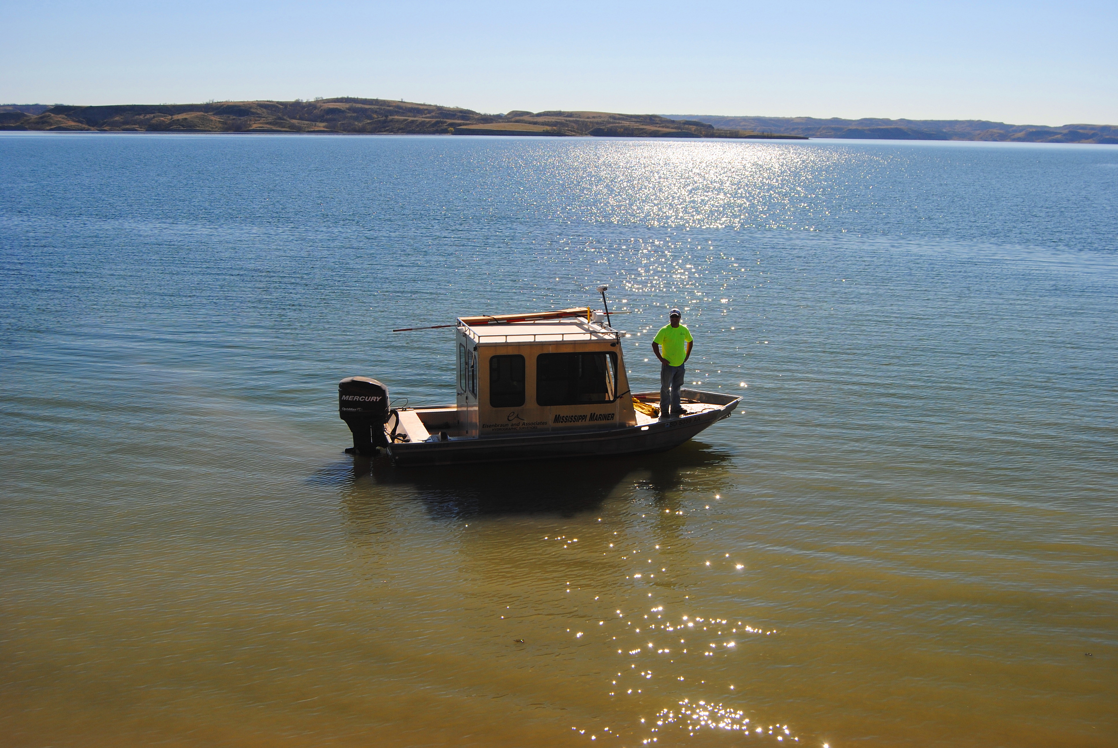
The hydrographic survey for each lake was conducted using a 18-foot survey boat equipped with a survey crew and electronic positioning equipment for the collection of horizontal positioning and a sonic depth sounder that met specifications required to obtain underwater elevations. The hydrographic survey data collected was processed using Hypack software. The coordinate system was UTM Zone 15, NAD 83 (2011) expressed in meters with all vertical survey data collected in NAVD 88 expressed in US survey feet. The ellipsoid heights acquired by GPS were converted to NAVD88 using GEOID12B.
Stockwell Engineers performed the hydrographic data collection and processing activities for each site. Pomme De Terre Lidar collection and processing (Task 2). For this task order, Woolpert performed an aerial lidar survey at 0.7-meter nominal pulse spacing (NPS) over the Pomme De Terre Lake covering ±58 square miles in Hickory and Polk Counties, MO. The data collection area was extended to the dam elevation 906-feet on the Pomme De Terre River.
Woolpert deployed a Cessna 404 aircraft equipped with a Leica ALS80 HP sensor for the collection of lidar data. The lidar data was processed immediately following the acquisition to verify the coverage had no voids or atmospheric anomalies. The accompanying GPS data was post processed using differential and Kalman filter algorithms to derive a best estimate of trajectory. The collected data meets ASPRS Positional Accuracy Standards for Digital Geospatial Data (Edition 1, Version 1.0) Guidelines. The lidar point cloud data was classified as ground and non-ground points and delivered in a single LAS 1.4 format file, one file for each deliverable tile. Breaklines were compiled and used to perform hydrologic flattening of water bodies, and gradient hydrologic flattening of double line streams and rivers. The lidar ground points and hydrologic feature breaklines were used to generate a new Digital Elevation Model (DEM) using Terrascan software. The new hydrologically flattened DEM was delivered in 32-bit floating point raster ERDAS .img format at a 1-meter pixel, based upon the 1,500-meter x 1,500-meter tiles in the NAD83 (2011), UTM Zone 15N, Meters. The vertical datum of NAVD88 US Survey Feet was used. FGDC compliant metadata was provided in extensible markup language (.xml) format for the project.

Get In Touch